Popular Posts

If you would like to see some Taking It Outside videos visit my YouTube Channel

Friday, December 3, 2010

Mystic Falls Trail in YNP

According to Yellowstone.net there are over 1,100 miles of hiking trails in Yellowstone National Park.  Considering that YNP encompasses 2.2 million acres I have no trouble believing the claim.  I was fortunate enough to hike a little over 12 miles of those trails in July 2010 - only 1,088 miles to go!

The longest hike was to see Osprey Falls near Mammoth Hot Springs. - See earlier post for review of the trail.

The second hike was the Mystic Falls Loop.  The trail begins at Biscuit Basin which sit on the northern edge of Upper Geyser Basin, which is home to the iconic Old Faithful Geyser.
Probably the most recognizable geyser in the world.
We parked our motorcycles at the Biscuit Basin parking lot and viewed the numerous geysers and springs that the boardwalks surround before hitting the trail to visit Mystic Falls and Biscuit Basin Overlook.  We saw Sapphire Pool which looks so inviting, but at 200+ degrees Fahrenheit is not the place for swimming.
Sapphire Pool is so clear, looks like a natural swimming pool. 
After looking at the other geysers and springs we started the trail on the west side of the boardwalk loop and quickly entered the pine forest.  We passed an information board that the trails from that area including the much longer Fairy Falls Trail and Summit Lake Trail.

The trail forks about 1/8 mile after leaving the boardwalk.  We choose to go right (counter-clockwise), but afterwards I wish we would have taken the trail clockwise.  The sloping is not as steep on the way up and the views descending would have been better in my opinion.
Map of some trails in the Biscuit Basin.
We encountered a series of switchbacks and ascended about 1,000 feet to reach the Biscuit Basin Overlook. From the overlook we watch Old Faithful erupt as well as some other geysers that also erupted.  We could see the features in Biscuit Basin, the Firehole River and most of the Upper Geyser Basin.  The view was spectacular.
Upper Geyser Basin as seen from the Biscuit Basin Overlook.
The Biscuit Basin Loop boardwalk.  Sapphire Pool can be seen.
We continued west on the trail as it ran on top of the ridge and through the forest still trying to recover from a fire many years ago.  After about 1/2 mile the trail has another fork.  To the right/west the trail goes to Fairy Falls.  We took the left fork and turned south towards Mystic Falls.
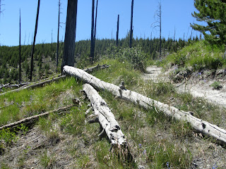
The trail continued on the ridge.  The effects of the fire is still visible.
The Little Firehole River seen from the trail on the ridge.
The trail soon begins a gradual descent. We could see Old Faithful again.  After another 1/2 mile or so we could see the crest of Mystic Falls.  We continued the trail and were able to get a great view of the entire 70 foot waterfall.  It was a great view.
The crest of Mystic Falls.
Mystic Falls
The trail descent a little farther and then flattened out as it continued to skirt the Little Firehole River.  The trail slows works it way slightly northward and away from the river, back into the forest and intersects the Summit Lake Trail.  We turned left and hiked past the first fork that we took to begin the hike.  Through the forest we hiked until we emerged back at the Biscuit Basin Loop boardwalk.

The hike is roughly a 3 mile loop from the parking lot and is easy to moderately strenuous.  The views are great and you will leave the crowd behind.  I am glad we took the hike.  It was really nice to see Yellowstone from areas that were not crowded and were very peaceful.

Monday, November 15, 2010

You're all wet! So am I.

For the second summer in a row my son and I (along with some friends) decided to do some rafting while on our  motorcycle trip.  Last summer we rafted out of Pagosa Springs, CO.  During our trip to Yellowstone National Park we decided to raft out of Gardiner, MT on the Yellowstone River.

Gardiner is right outside the famed north gateway to the Yellowstone National Park known as the Roosevelt Arch that was dedicated by President Theodore Roosevelt on April 24, 1903.
We stopped for pictures at the famous arch on our way back to camp.

There were four rafting companies each offering full and half day trips.  After doing some research and reading different reviews I chose the Yellowstone Raft Company.  We opted for the 1/2 day trip.  Four of us, including my son and I, got up early and got in a great hike to Osprey Falls prior to our afternoon rafting experience.

We met the rest of our group at the Yellowstone Raft Company store in the afternoon.  We changed into appropriate clothes, picked up our life jackets, and were briefed about the trip.  We loaded up in the vans and rode to the launching locations only about a 1/4 mile from the store.  We carried the rafts to the river and began the wet and wild adventure.  Since there were eight of us in our group and another couple we split up with five in each raft along with our guides.
Raft #1 had five from our group and a guide.
Raft #2 - my son is manning the front right of the raft and getting really wet!
Both of our guides were friendly, funny, and knowledgeable.  They pointed out different mountains, plants, and geological features, including Devil's Slide.  Our guide had a great sense of humor and kept us laughing.  He would skillfully steer the raft toward the biggest waves ensuring maximum splashes.
Preparing for a big wave.
The other group also had some big splashes.
During one stretch of the river the water was pretty calm, but still flowing at a good rate.  Anyone that wanted to was welcome to go swimming or float along side the raft.  That mountain water is a little chilly so I stayed in the raft, but some jumped in.

To the south we could see Joseph Peak and Gray Peak of the Gallatin Range in YNP.  The views were awesome.  We saw birds, but no mammals.  The river was flowing at a good rate so there was plenty of excitement.  Overall it was a much "wetter" adventure than our rafting trip in 2009.

If you are visiting YNP or that area and you want to do some rafting I would check out the Yellowstone Rafting Company.  They did a great job - we had fun, got wet, learned about the area, and we were kept safe.  What more could you want?

Thursday, November 4, 2010

Not as famous but awesome!

When this Texan was planning our trip to Yellowstone National Park a friend insisted in visiting an area outside the park that I had never heard of.  Reluctantly the side trip was included in our plans and I am so glad it was!  The Upper Mesa Falls and Lower Mesa Falls in Idaho do not have the name recognition that Yellowstone has, but they are beautiful and well worth visiting.

The falls are located on the west side of ID 47 a.k.a The Mesa Falls Scenic Byway.  From the west entrance to Yellowstone NP to the parking lot at the Upper Falls is about 50 miles.  If you are coming from the south part of Idaho you will take US 20 from Idaho Springs to Ashton and then turn east on ID 47/Mesa Falls Scenic Byway.  About 14 miles later the entrance will be on the left side of the road.  If you are coming from West Yellowstone you will travel US 20 to Island Park and then south for about 8 miles out of Island Park to the junction with ID 47.  Travel about 13 miles to the entrance to the Upper Falls.
Upper Falls in the morning light
The road to and the parking lot at the falls are well paved.  You will find restrooms, visitor center with exhibits, and a gift shop at the Upper Falls parking lot.  Access fee is $5/car or $1/motorcycle.  There are 9 campsites at $12/night with tables, fire rings, restrooms, and water available. Camping, hiking, backpacking, picnicking, and winter sports are allowed. More info and even more info.

A walkway from the parking lot/visitor center will take you to the overlook of the Upper Falls.  Upper Falls is 300 feet wide and plunges 114 feet creating a thunderous roar and a far reaching spray.  It is very impressive and is actually higher than the Yellowstone Upper Falls by 5 feet.  The spray keeps the sides of the canyon moist which produces a small ecosystem of its own. We saw numerous species of wildflowers and birds including osprey.  Eagles, deer and bear are known to frequent the area.
The only bear we saw was the rock below the falls that we thought looked like a bear
There is a mile hiking trail from the Upper Falls to the Lower Falls that takes hikers lower into the canyon and closer to the Lower Falls.  It runs adjacent to the Henrys Fork River and through some trees.  It is an easy hike.  You can view the Lower Falls from the Grandview Campground and Overlook or from the trail.  The Lower Falls plunges 85 feet creating a fantastic scene.
Lower Falls.  Notice the hiking trail in the canyon.
The two falls and area are pristine.  These two falls are the last two major falls in Idaho that have not be disturbed for irrigation or hydroelectric projects.  The low number of visitors make this an ideal location for hikers/campers wanting some time away from the masses.  The air is clean, the sound of the falls is relaxing, the surroundings are beautiful, and the neighbors are far away!
Henrys Fork River rolling toward the Lower Falls
It may not be Yellowstone, but that is a good thing and it is a beautiful area.  If you are in that area of Idaho I highly recommend you stop by the Mesa Falls and stay a while.

Monday, October 4, 2010

Osprey Falls in Yellowstone National Park

While on my July 2010 motorcycle trip to Yellowstone National Park (YNP) I could see a lot of geothermal features, wildlife, and natural features from the bike and I was able to park and take short walks to many of the famous sites such as Old Faithful, Grand Prismatic, the Upper and Lower Fall, and the Morning Glory Pool, but I wanted to see and experience YNP from less crowded vantage points.
 The pools have such vivid color.
One of the most famous sites in America - Old Faithful Geyser.
At nearly 370 in diameter the Grand Prismatic is the largest hot spring
in the USA and third in the world.
I wanted to get away from the crowds to see some of the more remote sites and two other men in our group were willing to do some hiking with me and my son.  One of the hikes we decided to go on was to Osprey Falls.  Our research indicated that the trail was "moderate," although at least one site designated the hike as difficult.

We left the West Yellowstone KOA early that morning grabbing breakfast at Ernie's Bakery (more about Ernie's later) and then road to the Old Bunsen Peak Road Trail trailhead - 5 miles south of Mammoth.

On the ride to the trailhead we saw two different coyotes (including one crossing the road near the trailhead), bison, elk, and a swan. Of course we saw steam from numerous geothermal features that are otherwise hidden behind trees and hills far away from the areas were visitors are allowed.  The ride was great - so little traffic and crisp cold air (approx 45 - 55 degrees - July 19, 2010).
Coyote near the trailhead early in the morning.
Peaks to the west of the trail.
We started on the hike around 8:50 A.M..  Once on the trail we were totally alone, just four of us.  It was quite peaceful and well worth the early ride.  We headed southeast along the Old Bunsen Peak Road past burnt forest, through grassland, and past Sheepeaters Cliffs.  The trail follows the set of vehicle tracks so for about 3.5 miles hikers have side by side trails.
Sheepeaters Cliffs were named after a sub-band of Shoshone Indians.
The trail skirts around Bunsen Peak and beside Sheepeaters Canyon.  The views of the canyon are awesome and at times dizzying.  At 800 foot deep the canyon is second only to the Grand Canyon of Yellowstone (in regards to canyons in YNP).  The column of basalt are clearly visible from the trail.
Wow - that is a deep canyon! 
After passing the Sheepeaters Cliffs and Bunsen Peak we turned south on the Osprey Falls Trail and entered the forest (still recovering from a fire years ago).  The trail quickly begins descending through a series of switchbacks.  We could hear the roar of the falls and see Gardner River long before we could see Osprey Falls.  The last 1/4 mile is a series of 14 switchbacks, often less than a foot wide, that descends 800 feet into the Sheepeaters Canyon and ends about 30 feet from Osprey Falls.
My son heading down the series of switchbacks as the trail nears the falls.

Osprey Falls and the trail - we are nearly there.

Osprey Falls - 150 foot falls.
The vertical cliffs rise straight up and the Gardner River crashes down 150 feet causing mist and spray several feet away from the base of the falls.  The area offers shade, solitude, and a relaxing chorus. 
A great seat to the spectacular site.
Our round trip distance was 9.1 miles (round trip).  I had been working out prior to the trip and felt ready for the hike, but I will tell you the hike back up those 14 switchbacks was tough.   We were in a hurry to meet the rest of the group for a 1/2 day river rafting trip in Gardiner, Montana so we had to push it.

It was well worth it.  I highly recommend the hike to Osprey Falls whenever you get to visit YNP.  You will see so much more when you get away from the crowds.  Be prepared and take water & snacks as well as other hiking type supplies.  Make sure you have comfortable shoes. Now go take a hike! 

Check out various video Taking It Outside including videos from YNP

Thursday, June 17, 2010

Time to go camping

My outside activities have been way too limited for the last 4 months, but I am looking forward to some camping next week.  A friend and I are riding our motorcycles up to Des Moines, Iowa and we will be camping on the way up and back.  My son is competing in the National Junior Forensic League tournament, that is why we are heading up that way.  This will be my first long trip on my new motorcycle - Yamaha Venture.

We will be camping in Petit Jean State Park and Mount Magazine State Park in Arkansas, Lake of the Ozarks State Park and Stockton State Park in Missouri, and staying in a motel while in Des Moines.

We also plan on visiting Mystic Caverns while in Arkansas. Of course we will visit other places and I will be able to post about the state parks, caverns, trails, restaurants, etc.

In July my son and I along with 7 others will be riding to Yellowstone National Park in Wyoming (never been so really looking forward to this trip).  Hopefully I will be more consistent with my posts.
Photo of Yellowstone Falls borrowed from http://grandcanyon.free.fr/images/cascade/original/

Friday, March 5, 2010

Hiking in the rain or snow.

There are few things worse than hiking with wet clothes.  Having quality waterproof yet breathable outwear is a top priority for me.  I don't won't to be caught in a precipitation without my ARC'TERYX Theta SV bib pants made with GORE-TEX.

The Theta SV pants have a high waist and a stretch back pannel that provides a snug, but comfortable fit.  It took me a couple of times of wearing them to get use to the high waist.  The waist band is adjustable which is really nice and the adjustable suspenders makes custom fitting easy.  The zippers on the pant legs zip about 3/4 of the way up making getting them on and off easily with hiking boats on.

The pants are made from what GORE-TEX calls Pro Shell fabric.  It is the same fabric used in their Pro Shell Men's jacket.  The fabric is stiffer than what I am accustomed to and it makes more noise than most fabrics, but the upside is worth it.

The pants are reinforced in strategic areas so that they will last longer.  The knees are cut and sewn in a way that makes the bending of the knees smooth and comfortable.  The fly zipper, the leg zippers, and the pocket zippers are all water-proof.  You can more info from the ARC'TERYX site.

I have actually worn the pants while riding my motorcycle in the rain and they are, as ARC'TERYX claims, waterproof as well as being great at cutting the wind!

Hiking or riding the Theta SV bib pants are comfortable and they will keep you dry while being breathable.  This is only the second outwear garment I have made from GORE-TEX, but it will not be my last.

I am also impressed with ARC'TERYX.  The pants are my only product from ARC'TERYX, but I will look at their products when I am shopping in the future.

Wednesday, February 24, 2010

Waldo Canyon near Manitou Springs, Colorado

Just west of  Colorado Springs and Manitou Springs and right off of US 24 is a nice hiking trail in Waldo Canyon. I left my son to play with his cousins at my sister's house in Colorado Springs and drove to Waldo Canyon for a nice easy/moderate hike one October Sunday afternoon (a couple of years back) and really enjoyed my hike.

Leaving Colorado Springs on US 24 I passed Manitou Springs, which is a neat town to visit also.  The trail head was about 2 miles west of Manitou Springs right off of US 24.  I am told that on nice days the parking lot can be full.  When I parked there was only one vehicle other than mine.
Waldo Canyon as seen from the loop/trail head intersection
From the parking lot I followed the trail east as it ascended up some landscaped steps and some switchbacks.  With the trail head and the first portion of the trail near the highway it was a little noisy, but the scenery was great.

At about 1.5 I had to make a choice of following the trail east or west, either way would loop around the canyon and bring me back to this intersection.  From this part of the trail I could see Manitou Springs.  After some consideration  I headed west (clockwise).
Trail heading west a distance from the intersection
The trail was well marked and easy to follow.  The ascent was gradual.  Not long after heading west the trail took me through a lot of trees.  I enjoyed the shade.  The trail slowly turns north and then back east where the trail heads east for a good distance.

I stopped and enjoyed the silence (once down in the canyon the noise of the highway is blocked) and a snack.  There are a lot of good boulders to rest on.

From the higher portions of the trail I could see Pikes Peak

Pikes Peak seen from north side of Waldo Canyon
The trail crossed a small stream several time, but crossing was easy.  There were numerous birds along the way and evidence of deer in the area.  The views of Pikes Peak and Colorado Springs were great.  The leaves were changing and the splashes of yellow & red were really beautiful.

The trail is less than 7 miles (6.8 according to this site).  Elevation gain is around 2000 feet.  I am not a expert hiker, but I would consider the trail easy to moderate.  I did enjoy having my trekking poles with me.

This short trail is a nice get away with some great views.  I think it is well worth the drive up US 24.  If you decide to take the trail in the morning leave early and drive past the trail head to Woodland Park and enjoy breakfast at The Hungry Bear.  You will have a great hike after an awesome breakfast.

Wednesday, February 10, 2010

Our first rafting trip.

For a few years I had wanted to do some rafting, but I was concerned my son was too young.  However, while planning my summer motorcycle trip (June 2009) to Colorado, with my son (12 at the time) and some other men, I decided we would take a 1/2 day rafting trip.

I found Pagosa Outside Adventures (POA) while searching online for rafting in the Pagosa Springs area.  I was greatly impressed with the friendliness and helpfulness of the personal when I called several months ahead of time to get information. I decided to go with POA and booked our trip.

When we arrived at 12:30 on our scheduled day, we were met with smiles, laughter, and energy.  The entire staff seemed excited about the trip, a trip I am sure by then they had already taken many times.  Since none of us had ever been rafting we had questions and each question was enthusiastically answered.

After everyone had the appropriate gear, we loaded the POA van and head to the launching point which was directly behind the Malt Shoppe (great place - maybe discuss in a later post).  The rules and procedures were given in a humorus yet understandable way (Photos by "Birdcage"). 

Six rafts were launch and the fun began.  The river began smooth and cold.  The trip took us through parts of the town and right by the Springs Resort & Spa, a luxury hotel that features natual hot springs.  We continued down the river and out of the town where we got to experience some level 2-3 rapids. 

We difted beside steep granite walls and mountain forests.  We saw bald eagles looking for food and we rafted by a site used during the filming of the John Wayne classic The Cowboys.  At about the 1/2 way point the rafts pulled over and we had time for a snack and necessary break.


Once back on the river the speed picked up.  We experience some whitewater, but it was never too big or too rough.  The scenery was great and there was some fun-loving splashing wars between the rafts. Our guide was very experienced and knowledgeble.  He added a lot to the experience with his commentary and humor.  (Photo by "Loose Wheel" Grant)

When we landed we all helped load the equipment back on the trailers.  On our ride back into town we saw a black bear, but none of us got a picture.  The bear ran once the vans got close.

This was a great experience and has motivated me to go rafting again.  Next time I am in the Pagosa Springs area I will be planning a full day trip with POA.  Give it a try, you will have a blast.

Thursday, January 28, 2010

Hiking Pikes Peak

There are two hiking trails, that I know about, to the summit of Pikes Peak; the Barr Trail and the Pikes Peak from the Crags Trailhead. The Barr Trail is 13 miles one way while the trail from the Crags is 12.5 round trip. I chose to hike Pikes Peak from the Crags which is on the west side of the peak while the Barr Trail is on the east side.

I left my sister’s house in Colorado Springs around 4:30 a.m. and drove US 24 west pass Pikes Peak to Woodland Park. I stopped and grabbed a couple of nutritional bars for breakfast. I continued west on US 24 to Divide and then turned on CO 67 towards Victor and Cripple Creek. 4.3 miles later I turned left on a gravel road that took me to the Crags Campground where the trailhead is located. On the way I passed Mueller State Park on the right and to the left was a ranch and a sign for the Rocky Mountain Camp and Crags Campground (3.5 miles). The trip was about 30 miles total from Colorado Springs.

The trailhead begins on the northeast corner of the parking lot and it was well marked. I made sure I had plenty of water, food, trekking poles, sunscreen, and other necessary items for a big day hike. I had read that the elevation gain would be 4100 feet. I did not measure it with my altimeter, but I bet that is accurate.

The sun was just starting to rise, but the mountain kept the west side dark and shaded for a long time. The trail ascended about .1 mile before it split to the left for the Crags Trail or to the right to Pikes Peak. Before the split on the left there are three pipes sticking out of the ground. 100 more feet and the trail divides. Turning right the trail descended and crossed a steam via a split log bridge and then turned left and ascended for over a mile with very little change of direction. As I was walking up that portion of the trail I saw a mule deer at a small stream, once he saw me he paused and then took off. I crossed the small stream several times. I suspect in the spring and early summer there is a good amount of snow melt making the stream bigger, in July there was very little water.

The trail suddenly turned left and then back right and the trail will cross an opening that looks like an old road. The timberline is visible to the north. The trail reentered the trees and began a series of switchbacks that ended above the timberline. Before reaching the timberline I saw a couple of Dusky Grouse (later I discovered that they are known to be in the Rockies, but are not commonly seen). The trail continued up the ridge to the east/southeast. This part of the trail is the second most difficult part with the final 500 feet being the most difficult. During the first part of the hike I could see the Crags for which the original trail was made. Once above the timberline I could see the entire Crags area and Mueller State Park. The vistas were awesome!

At the top of the ridge Pikes Peak is visible and still over 2 ½ miles away. The trail turned northeast and then east on a small road passing between a series of huge boulders. The trail turned north again, goes through the parking lot of Devil’s Playground (12,000 ft  - so named because of the way lightening jumps from rock to rock during thunderstorms), crosses Pikes Peak Road and turns southeast beside the road for about ¾ mile.

From a natural lookout area at about 13,000 feet I could see in all four directions. To the East I could see Colorado Springs and Lake Moraine. To the North I could see the Manitou reservoir, Woodland Park and Pikes National Forest. When looking west I could see Sentinel Point (12,527) and Mueller State Park. Looking South I could see Sheep Mountain (12,397 ft), Bighorn reservoir and Wilson reservoir.

The trail became very faint as it turned east through rocky tundra and to the north of Little Pike (13,363 ft). Little Pike is to the right of the trail, steep cliffs are seen off to the left and Pikes Peak is straight ahead. ¼ mile past Little Pike the trail becomes very steep as it becomes more like rock climbing. Big sharp rocks lead up to the summit and the visitor’s center parking lot, the end of the trail.  The views are amazing.

On my way back down to the car I passed a heard of Big Horn sheep.

With any hike in the mountains one should be prepared. In the Rockies there will be cool temperatures and windy conditions. Thunderstorms can arise at anytime. The trail I took is snow covered in late fall to early spring. Be prepared for changing weather conditions and enjoy a great trail to the peak that inspired Katherine Lee Bates to write “America the Beautiful” in 1893.

Tuesday, January 12, 2010

Jeeping in the San Juans

My brother-in-law had been telling me for years how much fun and invigorating taking a jeep ride over the mountains in the San Juans near Ouray was.  I decided to do just that during our annual motorcycle trip this past summer (June '09).  The guys and I rented two jeeps and tried it out ourselves.

We stayed 3 nights in cabins at the Ouray KOA, which is a great campground in a very pretty and quite area just north of Ouray.  We rented the two jeeps at the campground and picked them up at 4:30 on Sunday June 14, '09 and returned them before 5pm the next day.

We left the KOA around 8 after breakfast and headed into town.  We stocked up on snacks and drinks, after all there is not a Burger King on the Alpine Loop. :)

We drove south out of Ouray on US 550 for about 3+ miles and turn left on Country Road 878 a.k.a. The Alpine Loop.  We left the nice paved road and began a day long adventure. (Photo of 1/2 our group as they round a corner on the Alpine Loop)

Within the first 2 miles we hit some pretty big (by this amateur jeepist's standard) rocks and it was pretty rough, but became much better quickly.  The vistas were great.  To the south of the road snow covered Tuttle Mountain was visible.  (That is the picture at the top of the blog.)

The trail continued to ascend up the mountains and we passed several abandoned mines and cabins including Mineral Point that was founded in 1873.  Soon after passing Mineral Point we ascended above the timberline.  Snow patches were plentiful and the higher we went the more snow there was.  Snow melt made the road muddy in places and fed the mountain streams and falls.

Mineral Point as seen from the Alpine Loop.


Another abandoned mine on the loop.


The closer to Engineer Pass the colder it got and the muddier the roads were.  Prior to Engineer Pass there  is a big pull off area named Oh! Point.  There was plenty of room to park (room enough for our two jeeps, ten 4-wheelers that arrived from Lake City on the east end of the Alpine Loop with room to spare). The view was spectacular.  From Oh! Point we could see Engineer Pass and the road that continued east.  (See the next photo)

We continued to Engineer Pass (12,800 ft) in spite of one in our group who was having a difficult time with the sheer drop offs and narrow trails.  At the pass we were rewarded with an amazing view, cold winds, a lot of snow and the thrill of making it to our destination.  We enjoyed the moment and took several photos.


(Here is a link I found on Youtube of jeeps going to Engineer Pass that can give you an idea of the trail.)

We back tracked passed Oh! Point and headed to Animas Forks, an abandoned mining town.  Animas Forks is a great ghost town and is at elevation of almost 11,200 feet. Several buildings are still standing.  We walked around and in buildings. There is a lot history there.  Animas Fork at one time had a newspaper known for being printed at the highest elevation for any newspaper.  A record it still holds.

We continued west through California Gulch surrounded by snow.  At times the snow banks on either side of the trail were 8-12 feet high!  We passed Hurricane Peak (13,447 ft) and drove through Hurricane Pass and continued pass Red Mountain 1(12,592 ft) and down the appropriately named Corkscrew Gulch. (photo on the right was taken at the beginning of Corkscrew Gulch)


At the end of Corkscrew Gulch we come to US 550 and head back to Ouray.  This was my first jeep outing in the mountains, but it will not be may last!  My rating of the Alpine Loop and jeeping around the Ouray/Silverton area is: