Popular Posts

If you would like to see some Taking It Outside videos visit my YouTube Channel

Wednesday, February 15, 2017

Hiking to Upper Cascade Falls, Ourary Colorado

** Video link at the bottom of post **
I had visited Ouray several times, but until July 2016 I had only seen the lower Cascade Falls.  I had not hiked up to the Upper Cascade Falls and Chief Ouray mine.  The abandoned building of Chief Ouray mine can be seen high above Ouray to the east above Lower Cascade Falls, but Upper Falls can not be seen from town.

The trailhead is located in the Amphitheater Campground at the southeast corner of the parking lot and the campground is in the southeast corner of the town of Ouray.  The trail is well marked and easy to find.  There are other trailheads which intersect the trail.

Trailhead is easy to find
The trail meanders through the forest and begins to ascend up the side of the mountains with a series of switchbacks.  The trail starts at 8,475 feet and reaches 10,000 feet prior to making it to the falls. 

Early on the trail

An interesting grove on the trail
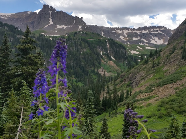
With an elevation gain of 1,525 feet in approx. 2.2 miles the trail is considered moderate-strenuous.  The views of the San Juan Mountains and the town of Ouray from the trail are awesome.

Looking south from the trail
The trail never gets above treeline, but the trees do thin out allowing great views of the area.  About 2 miles in the trail makes a sharp turn at the edge of the mountain, which is the high point of the trail,  and begins to descent to the falls.
The trails turns sharply just past the rocks on the right and descents to the falls.
It was not long after the switchback I began to hear Upper Cascade Falls and soon the falls came into view. 
First view of the final crest of Upper Cascade Falls
After spending some time at the falls I continued on the trail with a slight elevation gain to the abandoned equipment building of the Chief Ouray mine.
Chief Ouray equipment building

 The old building was surprisingly sturdy and it was obvious hikers had visited a lot.  I hike a little past the building stopping to enjoy a picnic of trail mix and turkey jerky while soaking in the peacefulness and views.  I hiked down the same trail and never saw another hiker.  I enjoyed the solitude.

I highly recommend the hike.  It is worth it.  Check out the video below slowing a lot more from the hike.  Please also visit the video on Youtube where you can like, share, comment and subscribe!

Watch video on YouTube

Tuesday, December 27, 2016

Camping when its cold - or any outdoor activity

Some like to camp when it is cold and there is a lot of hunting when the weather is colder.  Whatever outdoor activity one is involved with, staying warm with the appropriate gear is vital. 

This past spring I saw fleece-lined jeans at Cabela's and wondered how warm they would be in cold weather.  I kept an eye out for a sale and purchased a pair of the fleece-lined jeans during a sale event.  I tucked the jeans away until colder weather hit North Texas.
The weather turned cold in December so I pulled the fleece-lined jeans out of the closet.  The jeans are relaxed cut traditional 5-pocket jeans.  They fit appropriately and felt great.  The fleece is 100% cotton and feel great.  Construction and fabric are high quality.

The first time I wore them was on a lower 30 degree morning.  While walking the dog I could immediately feel the warmth was far superior to normal denim jeans. After walking the dog it was time to go out on a motorcycle ride.  During the ride the legs felt very comfortable and warm, even when riding at 60+mph.

I am really glad I purchased the jeans.  I liked them so much I have already bought a second pair.

Below is a video showing the jeans and my thoughts about them.  Check it out.  If you like the video please give it a thumbs up and subscribe to see future video reviews.


Sunday, December 11, 2016

Manitou Incline - what a workout!

It is difficult for hiker in North Texas to really prepare to summit a 14'er (mountain with elevation 14,000+) in Colorado.  We just don't have anything close to simulate the elevation.  Strength training and cardio training definitely helps and if a flat-lander can spend some a few days at higher elevations before the big hike it helps a great deal.

However; there is a great place to help a hiker prepare for a big hike in Manitou Springs, Colorado - the Manitou Incline.  (Video at the end of post)
Starting point for the Manitou Incline
The Incline is the remnant of a narrow gauge cliff (or funicular) railway built in 1907 and a few years later became a tourist attraction.  The views from the incline were and still are awesome.

View from about 1/2 way up the Incline
In the 1990's a rock slide damaged the tracks and the decision was made to not repair the tracks.  It did not take long for fitness enthusiasts to start hiking the Incline.  There were plenty of legal battles, but the good new is it is now a public hiking trail.
The average grade of the trail is 24 degrees with the steepest grade being 34 degrees!
The .88 miles (1.42km) trail has a "bailout" trail connecting to the Barr Trail (which ascends Pikes Peak) about 2/3 of the way up. Looking up the trail it looks like the top is not too far away, but there is a false summit about 300 steps below the real summit. 
That is a long way down and there is more to go.
Some accounts state there are about 2,744 steps on the incline.  I did not bother to count, I was trying to breath. 
The elevation really makes breathing difficult for a flatlander.
The base sits at 6,600 feet and the top is 8,600 feet, a 2,000 feet elevation gain in .88 miles make for a great workout.
Other hikers enjoying the view and feeling of accomplishment.
Most hikers descend by walking over the Barr Trail and following it down.  The Barr Trail down is a lot less steep, but about 2.7 miles.

The MapMyHike app gave me the following stats for second hike up the Incline (the first time was in 2014). July 19, 2015 - 1 mile, 1:04.29 hours, 2217 steps.

The same app gave me these stats for the hike down via the Barr Trail.  2.7 miles, 1:00.14 hours, 6151 steps.
I was tired, but felt good and I believe it helped me greatly.  A few days later I made the summit of Mt. Wheeler in New Mexico.  The incline is a great challenge for any hiker.

More videos about Taking It Outside  - Subscribe to channel and you won't miss future videos.

Friday, December 2, 2016

Lawn Lake Trail in RMNP

Rocky Mountain National Parks has 355+ miles of hiking trails in some of the most beautiful country in Colorado.  One trail that I really enjoyed (not only for the natural beauty, but also the historic significance) is the Lawn Lake Trail.


From Estes Park, CO take Hwy 34 west and enter RMNP at the Fall River entrance.  After about 1 – 1 ½ miles turn right on Old Fall River Road.  The parking lot for the trailhead is about 100 yards on the right.  The trailhead is on the north side of the parking lot.  There is an information board at the base of the trail.  


I hiked up to Lawn Lake and back, it was a 12.4 mile trip.  The trail's elevation gain is 2249 feet from trail head to the lake.  I found the trail well marked and easy to follow.  Watch for the trail to split about 1.8 miles from the trail head.  If you take the left fork you will be on the Ypsilon Lake trail so, stay to the right.


The trail has many switch back and provides a lot of great views of the famous Long's Peak (14,259 ft).  At times the trail places you near the edge of the steep Roaring River and allows you to see the massive destruction caused by the 1982 flood when the Lawn River dam broke.  The trail turns away from the river about 3 miles into the hike and runs into the surrounding forest.


The rock formations and boulders along the way add spectacular contrast to the forest.  The huge boulders decorate the trail and give hikers great places to sit and enjoy the surroundings.  About 1/2 of a mile from the lake the trail runs into the path of the great flood and gives a great view of how wide and massive the force was.  Lawn Lake, the goal of the hike, sets in the cup of the mountains at the top edge of the timberline.  The fragile tundra surrounds the lake and boulders provide seats for the human audience.  Filled with melted snow and rain it is clear, cold and a beautiful blue.  I took time to sit, relax, and enjoyed a snack.  It is a very pretty area and was well worth the hike.  (Photo from www.landscapeimagery.com)


The trek back to the trailhead allows a different perspective that provides great views.  It is a great trail worth every step.  The trail does not get a lot of visitors.  During my 6 hour hike I passed about 13 hikers on my way down and never saw any on my way up.  I highly recommend taking the hike up to see Lawn Lake.  I also highly recommend that you take a good pair of trekking poles with you and plenty of water, snacks, and a good camera.

Check out videos about Taking It Outside.

Wednesday, November 30, 2016

Life sure can get hetic!

It has been almost six years since my last post.  I could try to enumerate all the reasons I have not posted, but at this point it does not really matter.  I am just glad that I can once again post about "Taking it outside."

Lake in the Sangre de Cristo mountains near Cuchara, Colorado
During the years I was still able to do some camping and hiking.  I had some great trips and purchased some new gear, I just did not find or take the time to post.
Hammock camping is awesome!
Trinchera Peak (13,517 feet) - Colorado
I am now in position to be much more consistent with posts on campgrounds, hikes, gear, restaurants...  I hope all the info will be useful and interesting.
 Hummingbirds at North Park KOA near Gould, Colorado


Longhorn Caverns - Texas

I enjoy visiting caverns and there are several in Texas.  Some are pretty, some are unique, some are small, some are large and some have interesting history.  Longhorn Caverns near Burnet in the Texas Hill Country is a cavern with some history.

During the Civil War bat guano was mined to make gun powder.  A legend concerning the outlaw Sam Bass states Sam hid money from his activities in the cave.  Another story is told of a recuse of a kidnapped girl taken by Indians who hid in the cave.
Tour visit the large room
One of the interesting and unique formations
The stories surrounding the caverns led tourist to the area to see the sites.  By the 1020's the main room of the cave was being used as a dance hall and a place for concerts. 
Boys standing at the gated entrance to the cavern
In the late 1930's the cavern and many acres around it became a state park and open to the public.  In 1971 it was designated a National Natural Landmark.
Colorful formations

A dumbwaiter used the hole above to lower dishes and food during events in the main room. 

Entry to Longhorn Caverns
Longhorn Cavern sits inside the 645 acres Longhorn Cavern State Park and is open every day except Christmas Eve and Christmas Day.  Tours for the most part happen hourly (schedule changes during the winter - link to schedule and fees).

Footprint from an unknown human hardened in the stone
Next time you are in the Texas Hill Country stop by the Longhorn Cavern SP and enjoy the cavern.

Check out videos about Taking It Outside.

Thursday, February 24, 2011

An Enchanted Hike

244 miles southwest of Dallas, Texas sits one of the biggest rocks in the USA, Enchanted Rock.  Enchanted Rock is a batholith, a large protrusion of cooled volcanic magma.  This huge rock rises 425 feet above the surrounding area to a height of 1825 feet above sea level.  It is also the largest pink granite monadnock in the USA.
Enchanted Rock from park parking lot
The rock is part of the Enchanted Rock State Natural Area.  The park is located 15 miles south of Llano, TX and 15 miles north of Fredericksburg, TX just west of TX 16 on FM 965.

Hiking is popular in the park.  There are two main trails, Summit Trail and Loop Trail.  Loop Trail is 4 miles and goes completely around Enchanted Rock and crosses Sandy Creek a few times.  Summit Trail is only 6/10 of a mile, but it rises 425 feet.
On Summit Trail look up Enchanted Rock
The Summit Trail starts on the northeast side of the Interpretive Center (map of the trail) and quickly crosses Sandy Creek.  The creek is easy to cross unless there has been a heavy rain recently.  The last restrooms on the trail are east of the trail after crossing the creek.  A little pass the restrooms is a stationary telescope that visitors can use to look up the rock.  A little after  1/10 of a mile the trail turns north and begins to ascend through some boulders and plants. 
My son looking a little worn from the climb
After the 3/10 mark the trail splits with the Echo Canyon Trail continuing northwest to meet the Loop Trail and Summit Trail veering northeast and becoming very steep as the trail is solidly on the barren rock.  The trail continues to the summit of Enchanted Rock where the 360 view of the Hill Country is amazing.  The average incline on the trail is 30%.  

There is a lot of room on the summit for the hikers.  There are numerous fissures and hallows that can be explored.  Some are very steep and narrow so caution should be exercised.  There are some cave-like features and areas that are fun to explore.  My son and I spent time exploring the features.
We explored the fissures and canyons while at the summit
We hiked to the summit during March and took water with us.  If one was hiking in the summer months they would need a good amount of water because the heat on the rock can get intense.  There is not much shade to be found on the rock.
A great view of the countryside
Wildlife is common around the park, especially deer since Gillespie County has the highest concentration of White-tail deer in the US.  The wildlife is more likely to be seen in the early morning or at dusk.  Wild Turkey, wild boar, bats, squirrels, and fox are seen often in the park.  My son and I saw deer early that morning on the way to the rock, but only birds and lizards once at the park.

The park has 46 camping sites near the visitor center with shower facilities and three primitive camping areas. This is a great park for camping and hiking.  The Hill Country is a great place for lovers of the outdoors.  Enchanted Rock is a unique geological feature and well worth visiting.